One of the best things about visiting Chandler? You don’t have to go far to get a solid dose of desert beauty. Whether you’re up for a real hike or just want a chill walk in the sunshine, there are plenty of hiking and desert walking trails nearby—some with lakes, others with mountain views, and all of them offering that classic Sonoran desert feel.
Before you head out, make sure to take precautions, like bringing water, wearing real shoes (no sandals, trust us), and slathering on the sunscreen. You’ll thank us later.
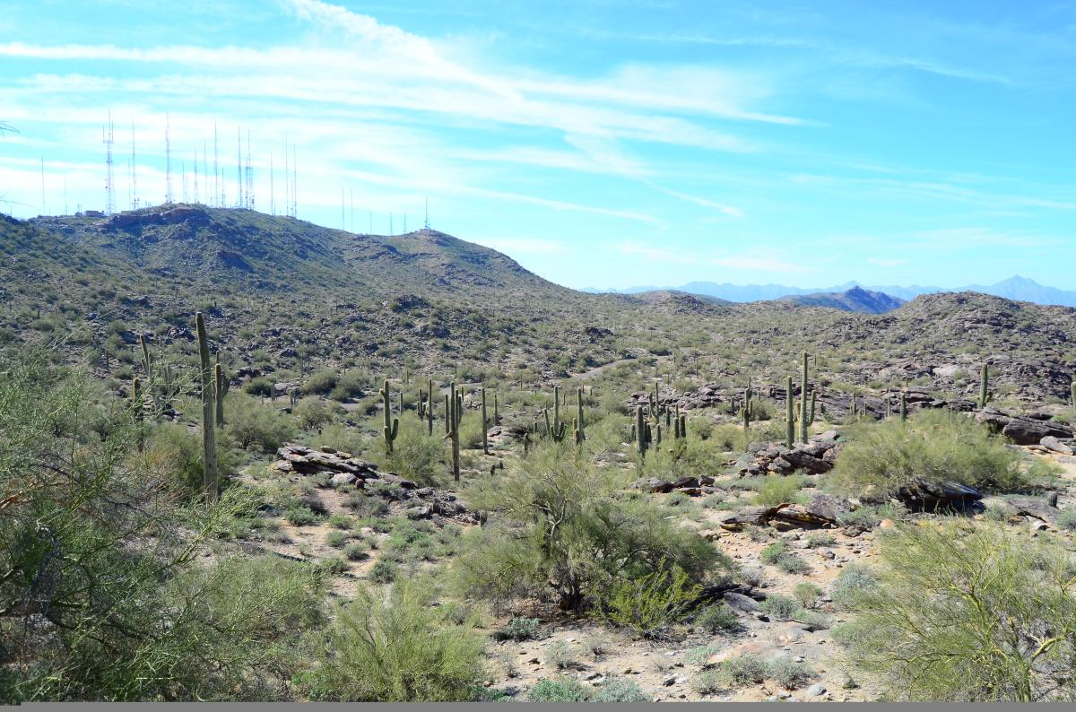
Hiking South Mountain Park and Preserve - Best for Big Views and Iconic Desert Vibes
- Main Entrance: 10919 S. Central Ave., Phoenix, AZ 85042
- Pima Entrance: 9904 S. 48th St., Phoenix
- Phone: (602) 262-7393
- Hours: 5 a.m. to 7 p.m. (Trails remain open until 11 p.m.)
- Fee: None
If you want sweeping views and dramatic desert backdrops, South Mountain Park is the move with more than 50 miles of crisscrossing trails. It’s actually the largest city-owned park in the country, so there’s a lot to explore.
For a solid challenge, check out the Holbert Trail. It’s a 2.5-mile climb (one way) up to Dobbins Lookout, where the views of Phoenix and the Valley are totally worth the sweat.
Just getting started? Try the Kiwanis Trail, a beginner-friendly, 1-mile out-and-back with cool stone dams from the 1930s scattered along the way.
More experienced? The National Trail runs the full length of the park (14.5 miles) with trail access from Pima Canyon near 49th Street and Guadalupe Road. You can mix and match routes for a longer hike if you’re feeling ambitious.
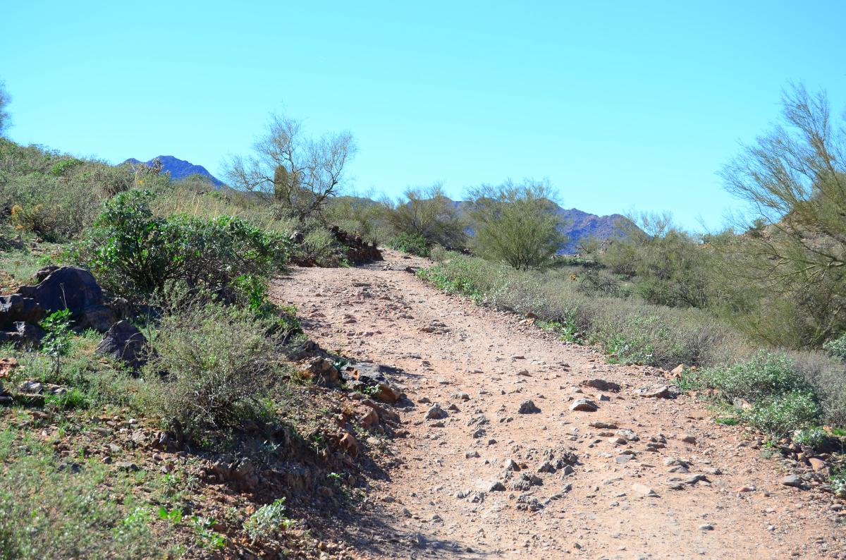
San Tan Mountain Regional Park - Best for Trail Runners & Desert Solitude
- Main Entrance: 6533 W. Phillips Rd., Queen Creek, AZ 85142
- Phone: (480) 655-5554
- Hours: Sunday - Thursday, 6 a.m. to 8 p.m.; Friday and Saturday, 6 a.m. to 10 p.m.
- Fee: $7 per vehicle
San Tan is a bit quieter than other spots around the Valley, and that’s part of its charm. You’ll get wide-open skies, saguaro-studded trails and that peaceful desert stillness at this regional park.
Try the Moonlight Trail (just over 1 mile) for a mellow loop that’s close to the visitor center. It’s great for a quick outing or beginner-friendly jog.
Want more? Park at Rock Peak Wash Trailhead, hike to Malpais Trail, and you’ll get a 6-mile round-trip through volcanic rock and rugged terrain.
The Goldmine Trail (2.5 miles one way) offers views from two overlooks and even passes the graves of two old miners near the north end (random, but kind of cool).
Bonus: After your hike, swing by the Arizona Fallen Heroes Memorial or check out the Desert Tortoise Habitat near the visitor center.
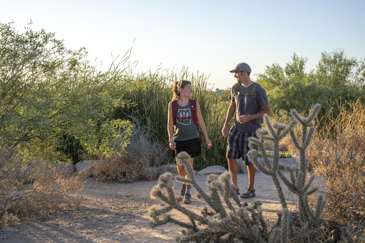
Veterans Oasis Park - Best for Water Views & Bird-Watching
- Address: 4050 E. Chandler Heights Rd., Chandler, AZ 85249
- Phone: (480) 782-2890
- Hours: Monday - Thursday, 8 a.m. to 8 p.m.; Friday, 8 a.m. to 5 p.m.; Saturday, 8 a.m. to 3 p.m.
- Fee: None
Right in town, Veterans Oasis Park is one of the easiest places to enjoy the outdoors without going full “hiker mode.” There are 4.5 miles of trails, including a paved loop around a 5-acre fishing lake—great for strollers, wheelchairs or just lazy Sunday strolls.
One super cool feature is the self-guided Chandler Solar System Walk. A stretch of path is lined with mini planets spaced out to scale (each step equals 1.5 million miles in space).
Head off the pavement to find butterfly gardens, hummingbird spots, elevated viewing decks, and even a little waterfall (yep, in the desert!).
The park is a birdwatcher's paradise, with more than 150 species having been spotted here. From November to April, Desert Rivers Audubon offers free, guided bird-watching tours on the first Saturday of each month.
And don’t miss the Chandler Nature Center, a great spot to learn about local wildlife or grab a fun, desert-y souvenir at the Owl's Nest Nature Store.

Paseo Vista Recreation Area - Best for Quiet Walks & Open Space
- Address: 3850 S. McQueen Rd., Chandler, AZ 85286
- Phone: (480) 782-2754
- Hours: 6 a.m. – 10:30 p.m.
- Fee: None
Once a landfill (really!), the Paseo Vista Recreation Area has been transformed into a unique park with over a mile of walking trails, a disc golf course, a dog park, an archery range, and more.
It’s perched on rolling terrain, so even though the hills are man-made, the 40-foot-high overlooks give you surprisingly great views of the East Valley.
From here, you can also hop on the Paseo Trail, which follows the Consolidated Canal. Go south for about 2 miles for a short, scenic outing. Or head north for roughly 4.5 miles if you’re looking to stretch your legs a bit more.
The paved side is perfect for walking, biking, or jogging, while the dirt path on the other side is open for horseback riding.